
RACE AzBT_100 ENDURANCE
100km

THE ULTIMATE CHALLENGE.
The 100K race of the Azores Bravos Trail® is a demanding and profound crossing of Terceira Island. It is a test of endurance, persistence and a direct confrontation with a landscape shaped by volcanism, the Atlantic and human history.
100K MAP
AID STATIONS · 100K
Technical details and timetables. All times are local (Azores). Swipe horizontally to see all columns.
| Station | Location | GPS | Altitude (m) | Partial distance (km) | Total distance (km) | Partial D+ (m) | Total D+ (m) | Partial D− (m) | Total D− (m) | Fastest | Slowest | Safety sector | Cut-off time |
|---|---|---|---|---|---|---|---|---|---|---|---|---|---|
| — | Miradouro do Facho | 38.734292, -27.053555 | 70 | — | — | — | — | — | — | 0:00 | 0:00 | — | 0:15 |
| PAC1 | Serra do Cume | 38.713404, -27.115180 | 548 | 9,70 | 9,70 | 637 | 637 | 637 | 159 | 1:08 | 2:07 | — | 2:00 |
| PAC2 | Golfe | 38.735015, -27.159541 | 319 | 12,00 | 21,70 | 216 | 853 | 159 | 605 | 2:32 | 4:46 | — | 5:00 |
| PAC3 | Agualva | 38.771838, -27.176163 | 149 | 13,00 | 34,70 | 489 | 1 342 | 658 | 1 263 | 4:04 | 7:37 | — | 7:00 |
| PAC4 | Algar do Carvão | 38.728179, -27.216472 | 561 | 8,30 | 43,00 | 615 | 1 957 | 203 | 1 466 | 5:02 | 9:27 | — | 9:30 |
| — | Crossroads 1 | 38.735277, -27.222355 | 590 | 1,40 | 44,40 | 59 | 2 016 | 31 | 1 497 | 5:12 | 9:45 | — | — |
| PAC5 | Mistérios Negros | 38.731826, -27.269072 | 551 | 6,80 | 51,20 | 145 | 2 161 | 183 | 1 680 | 6:00 | 11:15 | — | 12:00 |
| PAC6 | Biscoitos / Life Base | 38.793844, -27.265477 | 86 | 12,10 | 63,30 | 229 | 2 390 | 698 | 2 378 | 7:25 | 13:54 | — | 14:00 |
| PAC7 | Vimieiro | 38.758884, -27.250660 | 455 | 12,30 | 75,60 | 596 | 2 986 | 223 | 2 601 | 8:52 | 16:37 | — | 17:00 |
| — | Rocha do Chambre | 38.751835, -27.235167 | 713 | 3,00 | 78,60 | 295 | 3 281 | 43 | 2 644 | 9:13 | 17:16 | — | — |
| — | Crossroads 2 | 38.735277, -27.222355 | 590 | 4,60 | 83,20 | 214 | 3 495 | 323 | 2 967 | 9:46 | 18:17 | — | — |
| PAC8 | Furna do Enxofre | 38.725708, -27.233784 | 551 | 3,20 | 86,40 | 77 | 3 572 | 124 | 3 091 | 10:08 | 18:59 | — | 19:00 |
| — | Serra do Morião | 38.700252, -27.217029 | 562 | 5,80 | 92,20 | 213 | 3 785 | 202 | 3 293 | 10:49 | 20:16 | — | — |
| PAC9 | Nasce Água | 38.679394, -27.212809 | 196 | 3,60 | 95,80 | 53 | 3 838 | 419 | 3 712 | 11:14 | 21:03 | — | 21:00 |
| FINISH | Angra do Heroísmo | 38.650922, -27.223353 | 42 | 4,30 | 100,10 | 95 | 3 933 | 255 | 3 967 | 11:45 | 22:00 | FINISH | 22:00 |
MANDATORY / RECOMMENDED EQUIPMENT
| MANDATORY EQUIPMENT | 100K | 50K | 35K | 15K / WALK |
|---|---|---|---|---|
| Race bib (provided by the Organisation and visible) | × | × | × | × |
| Hydration backpack or belt | × | × | ||
| Water reservoir(s), 1 litre (minimum combined capacity) | × | × | × | |
| Water reservoir(s), 0.5 litre (minimum combined capacity) | × | |||
| Emergency blanket (min. 100 × 200 cm) | × | × | × | × |
| Working mobile phone | × | × | × | × |
| Hooded waterproof jacket | × | × | × | × |
| Cup | × | × | × | × |
| Whistle | × | × | × | × |
| Headlamp + spare battery/batteries | × | |||
| Rear red light | × | |||
| GPS tracker (provided by the Organisation and collected by the athlete before the start, at the start area) | × | |||
| Identification document | × | × | × | × |
| RECOMMENDED EQUIPMENT | 100K | 50K | 35K | 15K / WALK |
|---|---|---|---|---|
| Hydration backpack or belt | × | |||
| Food reserve | × | × | × | × |
| Elastic bandage or ligature (min. 100 × 6 cm) | × | × | × | × |
| Medication (e.g. sunscreen, anti-chafing lotion) | × | × | × | × |
| Change of clothes | × | |||
| Poles | × | × | × | |
| Spare headlamp | × | |||
| Head protection (buff, hat or cap) | × | × | × | × |
ROUTE DESCRIPTION
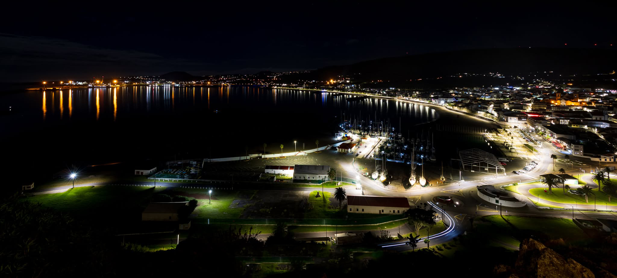
PRAIA DA VITÓRIA.
The race starts at Miradouro do Facho, in Praia da Vitória, with the ocean defining the horizon. The route quickly gains altitude towards Serra do Cume, where the iconic Manta de Retalhos reveals itself in all its grandeur, creating one of the Azores' most emblematic landscapes.
The route then follows Trilho das Relheiras de São Brás, where the rock preserves the deep tracks left by old carts, before crossing open pastures and climbing to Pico do Boi. The descent leads into the dense Matas da Agualva, where the enclosed greenery offers coolness and a brief respite before entering one of the race's most remarkable areas.
Once in Agualva, the route heads directly towards Algar do Carvão, one of the island's great natural symbols. Descending into this dormant volcano is a unique, almost solemn moment of direct contact with the depths of the Earth. Back at the surface, athletes face the legendary Trilho dos Mistérios Negros, a rugged and impressive landscape shaped by the 1761 eruption, where the technical terrain demands complete concentration.
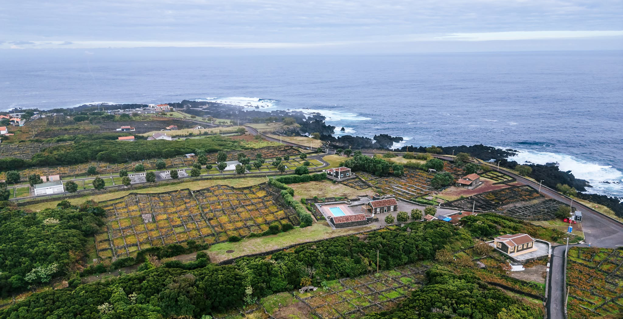
BISCOITOS.
The route then descends towards the north coast, reaching Biscoitos, where basalt vineyards and the proximity of the sea signal a clear change of scenery. From here, the race gains altitude again, leading athletes to the most symbolic point of the Azores Bravos Trail®.
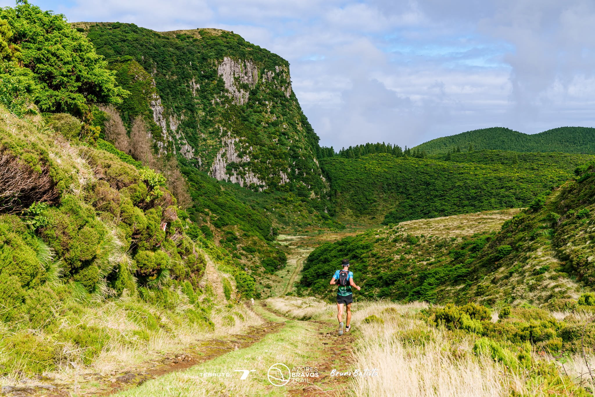
Reaching Rocha do Chambre, the true icon of the event, is one of the race's most memorable moments. From the top, sweeping views over the island offer a powerful perspective on the distance already covered and the challenge overcome. It is a place of contemplation, effort and identity, where the AzBT® spirit is felt in full.
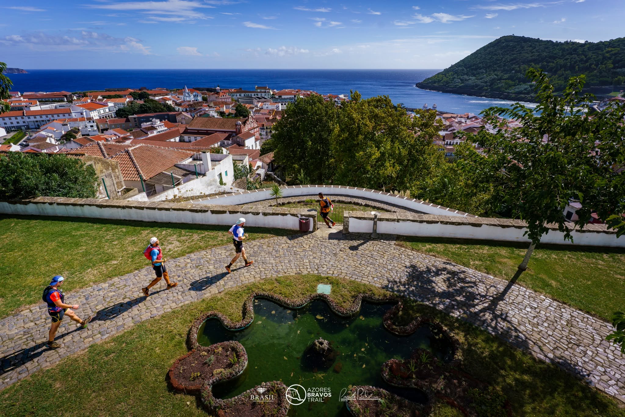
ANGRA DO HEROÍSMO.
After Rocha do Chambre, the route heads towards the south of the island, crossing demanding trails and open landscapes as fatigue sets in. Entering Angra do Heroísmo, a UNESCO World Heritage city, marks the beginning of the final effort. Its historic streets lead athletes to Parque Municipal do Relvão, where this tough, intense and unforgettable race ends.
Completing the 100K race of the Azores Bravos Trail® is more than finishing a race. It means crossing the island, facing its wild nature and emerging transformed by the experience.